Sunday, August 10, 2008

2008.27.120 - Roll the Bones

Our paddle began on a sunny Sunday.
Really.
It did.
I have photographic proof.
But what seemed like a sure thing for a paddle became an almost constant 50/50 proposition.
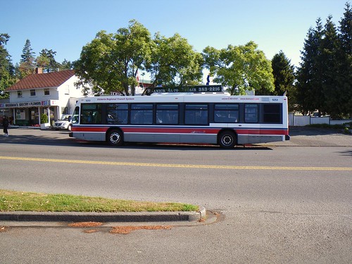
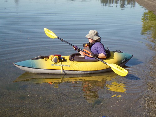
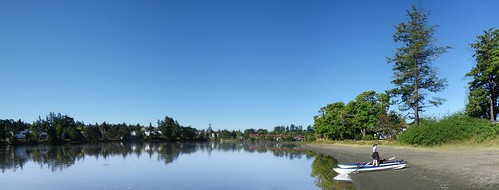
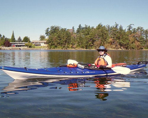
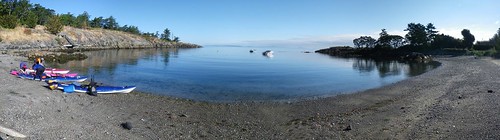
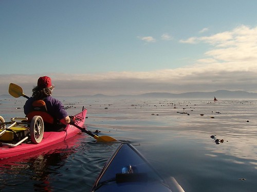
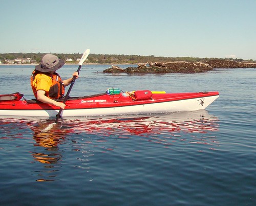
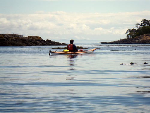
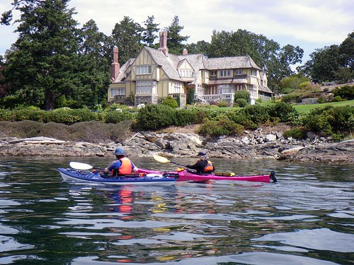
The weather called for clearing skies and maybe a slight breeze. At Cadboro Bay, we found the slight breeze alright, and then some. The wind was blowing, not a gale or anything, but certainly stronger than we had been expecting. Paula, Alison, Louise, Richard and myself were hoping for a paddle out to Discovery Island, but the weatherman looked like he might be playing his usual tricks on us today. As we looked out into the bay we saw Discovery Island disappear behind a fog bank. So much for the clearing skies.
2008-08-10 Chatham Island 413

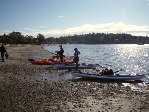
We decided to take a chance and launch anyway. We stayed along the north side of the bay, heading for Flower Island where we would reassess what the weather was doing. But we didn't get far before the fog bank rolled right over us.
2008-08-10 Chatham Island 419

By the time we got to Flower Island the fog had pretty much burned itself off. Now our only real concern was the wind and the currents. If the Baynes Channel freight train was running, a crossing might not be possible.
2008-08-10 Chatham Island 424

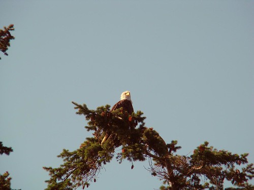
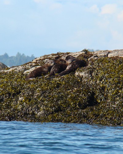
We paddled around Flower and saw the local eagle sitting in his tree. We also saw a family of three otters scamper up the rock.
2008-08-10 Chatham Island 488

On the other side of Flower, we saw more otters. There's at least four here, maybe five, so we think this might be a second family of otters, different from the first. We were still dubious about our planned crossing to Discovery, so I jokingly said after I snapped some pictures that I could go home now, I had otter pictures. Little did I realize that a few minutes later, we would almost go home.
2008-08-10 Chatham Island 496

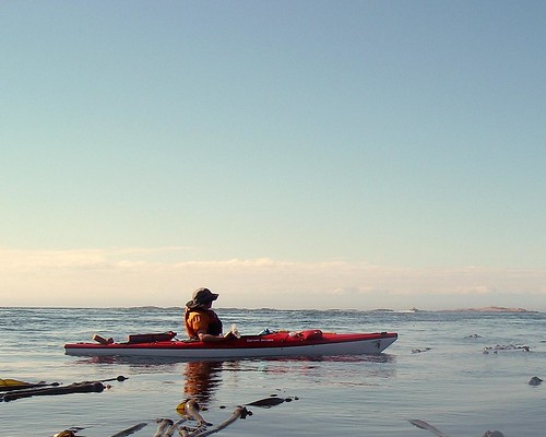
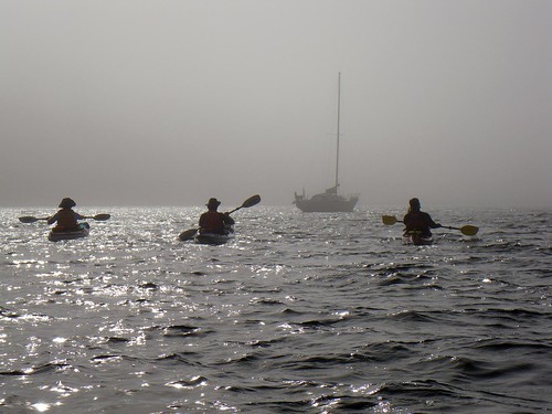
We decided to roll the bones and head further out to Jemmy Jones Island. Here we could get a good look at the currents between there and Discovery. But Discovery had disappeared again. Another fog bank had rolled over it.
2008-08-10 Chatham Island 431

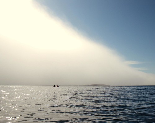
We pressed on towards Jemmy Jones and soon the fog bank rolled over us. Again.
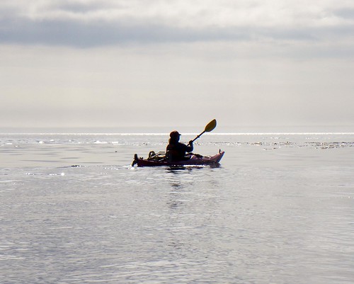
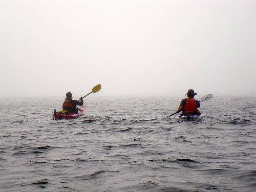
Halfway between Flower and Jemmy Jones, we couldn't see a thing in front of or behind us. We saw no visable landmarks. We were blind.
I had taken a compass heading before we started crossing (as had Paula) and it's not a long crossing by any means, but it was a little disconcerting to be paddling about blindly for a few minutes.
Despite the fog, we reached Jemmy and stared out at where Discovery should be. We couldn't see anything.
2008-08-10 Chatham Island 435

At that point, our paddle seemed over for the day, and we decided to go around Jemmy and follow our compasses and noses back to Cadboro Bay. We had started back, when I took one last look behind me. The fog had rolled off Discovery and suddenly we were in (relatively) clear skies again.
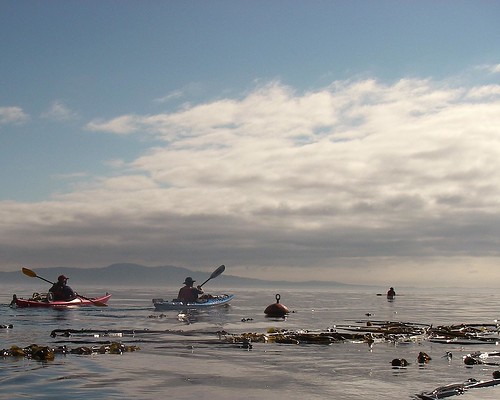
The currents had us a little worried; they seemed to be running a little strong, and certainly the weather was not behaving as forecast at all. Richard didn't wait and pressed on ahead. The rest of us hesitated for a moment, then got caught as we waited for some powered craft to pass. By then, the currents (as the current charts predicted) had died down a fair bit and the rest of us headed out too.
2008-08-10 Chatham Island 447

It's actually a group of islands, the major ones named Strongtide, Vantright, Griffin, Alpha, Chatham and Discovery. Chatham and Discovery are the largest, and that's the shorthand name the local kayakers use for this destination. Let's face it: as a kayaker, do you really want to jinx your paddle by saying that you're going to Strongtide Island? That's just asking for fate to get involved....and probably not in a good way. And after all, that's where I went upside down.
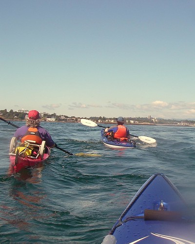
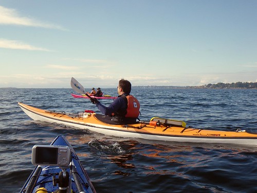
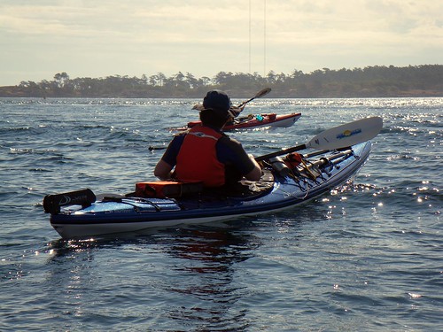
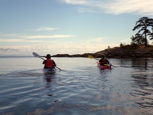
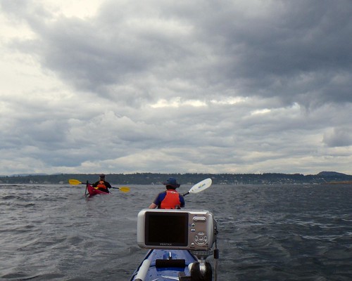
Anyway, here Richard is going between Strongtide and Chatham.
2008-08-10 Chatham Island 453

We decided to split up here. Richard had been around Chatham but not Discovery, and Louise and I had been around Discovery but not Chatham. So Alison and Richard decided to go around Discovery, while Paula, Louise and I would go around Chatham.
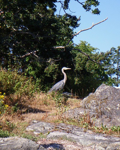
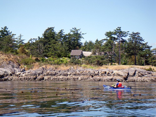
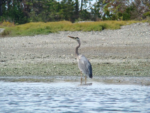
We ducked into Puget Cove on the north end of Chatham. On a good high tide you can get quite a long way in. No such luck today but I did see a heron. We also saw our third different family of otters of the day here.
2008-08-10 Chatham Island 505

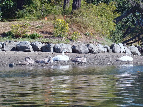
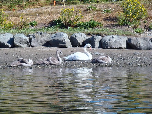
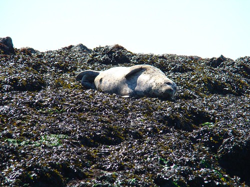
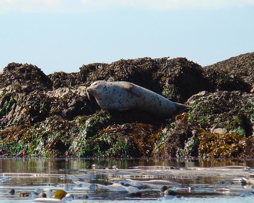
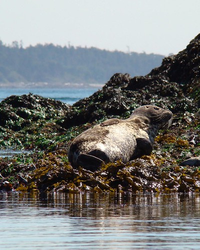
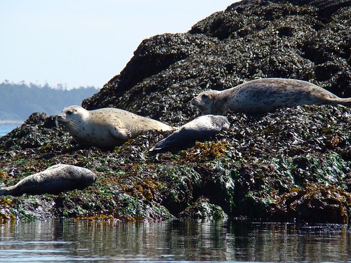
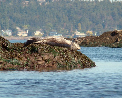
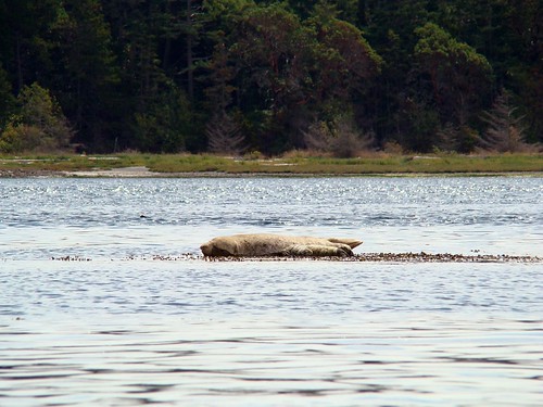
There were lots of seals about today, but we kept a respectful distance.
2008-08-10 Chatham Island 510

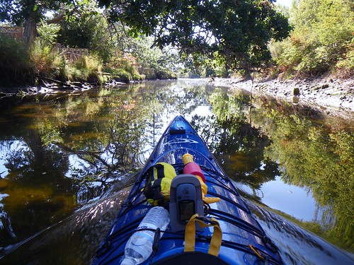
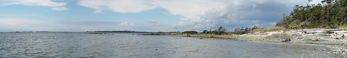
It's a beautiful place to paddle.
2008-08-10 Chatham Island 460

We went around Chatham, then down the channel between Discovery and Chatham. Here we met a couple we saw launching their kayaks off a beach. They looked as though they may have been camping, but I'm not sure. They were in short poly playboats they had rented and only had a vague notion of the tides and currents in the area. They were obviously novices; the woman was using her paddle backwards. I knew we were in a period of slack and suggested that if they were going to go somewhere, now would be a good time. The currents can play nasty tricks on unsuspecting paddlers, and even on suspecting paddlers. And it didn't help matters today that we now saw storm clouds over our launch point as we headed back. Storm clouds! It's supposed to be sunny!
The rookies headed off in the general direction the Chain Islands back towards Willows Beach.
Chatham Pano 2

We headed back to Cadboro Bay, glancing over our shoulders for signs of Alison and Richard. What we didn't realize was that after going around Discovery, they had doubled back between Vantright and Strongtide so they were going to be crossing to the north of us. We assumed that they would come around Discovery and keep going down the same channel that we had. So we were always looking in the wrong spot for them. We came out the south side of Chatham, and they came out the north side.
As we headed back, we encountered some big wake from a small pleasure craft. Afterwards, Paula said it felt she was going up three feet. I said it felt like I was falling five.
As the waves approached, I rested my paddle on my kayak and held my camera in front of me, determined to get a good shot Louise and Paula in the waves. Whenever we've encountered wave action, I've never been able to get a good picture that really looks like what it feels like on the water.
Anyway, the first couple of waves hit and they were big, but not so bad. Then I saw a big one coming and realized that I can't paddle very well with my digital camera! I dropped it in my PFD pocket and grabbed my paddle and --oh man, it felt like climbing a wall! I swear I got five feet of air! In reality, it probably wasn't nearly as exciting as I thought it was. But it was fun! We whooped and hollered!
As usual, the pictures don't do the waves justice. But you can see the pink stern of Paula's kayak pointing up in the air as she heads down into the trough.
2008-08-10 Chatham Island 471

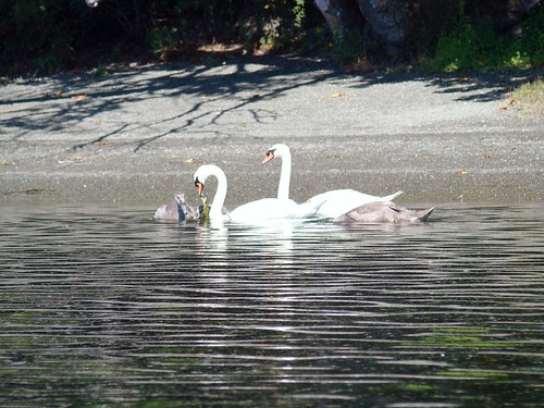
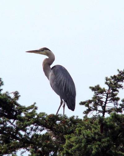
We paddled around Flower Island again, and the eagle had given up its spot in the tree to this heron.
2008-08-10 Chatham Island 522

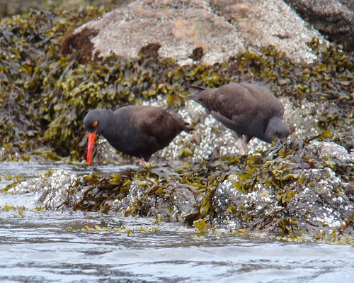
These oystercatchers went about their business as we drifted by.
2008-08-10 Chatham Island 533

It turns out that Alison and Richard were only about ten minutes behind us and beached just after we did. Just as we never saw them, they never saw us. Although they could have sworn they heard some whooping and hollering ahead of them...
2008-08-10 Chatham Island 476

Chatham Island
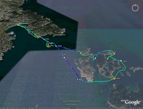
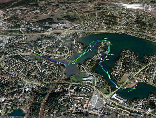
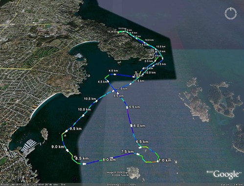
Trip length: 13.28 km
My pictures are here.
Download the GoogleEarth kmz here.

Tuesday, August 5, 2008

2008.26.119 - Natural Science

No doubt you are asking yourself, "Hey, this is a kayaking blog. Why the EXPLETIVE DELETED is there a picture of a Victoria Transit bus on here?"
This is a NovaBus, built in Québec and the latest addition to the local fleet, and has been in service about two years.
And what has this got to do with kayaking? It happens to be a little known fact that you can transport your kayak on a bus.
2008-08-03 Portage Inlet 001

To offer proof of this notion, may I present Exhibit One: Paula and her kayak in a bag. She caught the bus a block from her house on the other side of town and rode directly to today's kayaking put-in on The Gorge.
2008-08-03 Portage Inlet 002

In about fifteen minutes, she's on the water. She's following in the footsteps of well-known commando kayaker Dubside. (We thought of calling her Paulaside, but that just sounded like a crime. And DubPaula is the name she's saving for her spoken-word/reggae CD.)
2008-08-03 Portage Inlet 013

She's joining Louise and myself for a paddle from The Gorge into Portage Inlet on another wonderful and hot summer day. Paula's interested to see if we can find anymore of those glooby egg sack things that we've seen in past fall paddles. We're looking for them a little earlier than usual, so it will be interesting to see if we spot any.
Gorge Pano

I'm more interested in swans. As we crossed under the Admirals Road bridge, we could see the bird deflectors added to the power wires. These were added last year after the local family of swans (which we've photographed here and here) were electrocuted and died. However, earlier this year a new family of swans moved into the area and on May 18, Louise and I saw them and their six little swan chicks. We were curious to see how they were making out and were hoping to spot them. Between the glooby egg sack and the swans, we were starting to feel like amateur biology scientists.
2008-08-03 Portage Inlet 019

I never seem to get many pictures of ducks, so here's one for all you duck lovers out there.
2008-08-03 Portage Inlet 056

We didn't have to wait long to see the swans.
2008-08-03 Portage Inlet 074

It looks like only three babies survived, but they seemed to be in good shape. They sure are a lot bigger than they were three months ago. The family was quite relaxed as we drifted by.
2008-08-03 Portage Inlet 094

Louise is enjoying the beautiful day on the water.
2008-08-03 Portage Inlet 049

We made it to the farside of the Inlet and headed up Craigflower Creek. The tide was low (and getting lower) so we were a little surprised that we could make it in. We hoped to go as far as the tunnel under the Trans-Canada highway as we've done before, but the water level was simply too low and we had to turn around at the Helmcken Road bridge. This is a beautiful little creek.
2008-08-03 Portage Inlet 045

We had seen a few egg sacks in the Inlet, but we also found some in the Creek. We were a little surprised, figuring that the water would be fresher in the creek as opposed to the saltier water of the inlet, but Paula tried the creek water and pronounced it "brackish."
2008-08-03 Portage Inlet 040

We had to hustle out of the creek because we realized that the tide was still heading out and we didn't want to get trapped. Back in the inlet, I was only able to get one picture of a heron the whole day. This is it.
2008-08-03 Portage Inlet 048

As we returned to our launching point, the swans were swimming nearby. This is how to spend a summer day -- playing on the beach!
2008-08-03 Portage Inlet 114

Portage
Trip Length: 5.8 km
My pictures are here.
Download the GoogleEarth kmz here.

Sunday, August 3, 2008

2008.25.118 - Time Stand Still

Telegragh Bay Pano

Paula, Alison, Louise and I put in for a paddle at Telegraph Bay. We couldn't ask for a better day weather-wise. The early morning clouds were just burning off, and the promise of sunshine made us eager to start.
2008-08-03 Chain Islands 009

Paula is trying to catch up to Alison way off in the distance. Perhaps the weight of her handy-dandy home-made wheels was slowing her down. Actually, she put together quite the nice little rig for walking her boat to the beach.
2008-08-03 Chain Islands 007

The issue we were facing was one of currents. We were hoping that we could ride the outflowing current from Telegraph Bay around Ten Mile Point towards Willows Beach. We were expecting a brief period of slack tide that we hoped we might exploit to make a quick dash out to the Chain Islands. Then we would have the current with us again as the tide turned for the paddle back. But as we rounded Ten Mile Point, we could see that the "freight train" through Baynes channel was running and showing no sign of slowing. We ventured out a bit to check it out, but we could see whitecaps and swiftly moving water, so we decided to stick close to shore and head towards Cattle Point and reassess whether we would cross to the Chains or not.
2008-08-03 Chain Islands 081

But as we paddled along the shore, we could see the current die off. The slack had come, just as predicted. We changed course and headed out for the Chains.
2008-08-03 Chain Islands 468

We encountered little current or trouble heading out and soon we were at the Chains watching the seals basking in the sun. Usually we see some eagles out here, but not a one today. However, the number of seals more than made up for it. If you like seals, this is your place. It even smelled like seals!
2008-08-03 Chain Islands 515
2008-08-03 Chain Islands 510
2008-08-03 Chain Islands 548

We felt like we could've stayed out there all day, but we knew that we only had a short slack, so we didn't dawdle and were soon heading back. And we hit a patch of rough water but we made it through with no problem.
2008-08-03 Chain Islands 240

We paddled past a small group of islets that were also covered with seals. We just couldn't get away from them.
2008-08-03 Chain Islands 547

I like this picture. The seal's head pops up, and it looks like he's saying, "Uh guys, there's some humans over there...."
2008-08-03 Chain Islands 538

We tried to keep our distance from the seals as some of them were clearly very young, but they were all over the place and we kept stumbling upon them.
2008-08-03 Chain Islands 555

We could have kept paddling all day. As it was, we were out for nearly four hours, but we felt like we could have gone for hours more. As we approached Telegraph Bay, we could see James Island beckoning us. But Louise, like the rest of us, reluctantly turned back to shore and the end of our paddle.
2008-08-03 Chain Islands 502

Chains
Trip Length: 15.2 km
My pictures are here.
Download the GoogleEarth kmz here.