Wednesday, December 31, 2008

Paddle Stats 2008

I managed 38 paddles in 2008, not a bad total considering there were three extended periods the year when paddling was not possible: my eye surgery in early summer, Louise's hand injury later in the summer, then the record-breaking cold and snow in December.
image (1)

The weather was much improved with more sunny day paddles this year over last year. Most forms of inclement weather went down this year, including cloudy days, rainy days and foggy days. Snowy days did rise slightly, but even though most of December turned into a near total wash out due to very unusual cold and snowy conditions, we still had fewer bad weather cancellations than last year. (And what crazy weather it was. On December 23, Victoria had more snow on the ground than any any other urban centre in Canada. And more than the North Pole. Santa felt right at home here as we enjoyed only our fifth white Christmas since 1965. I shoveled snow for 90 minutes on Christmas Day. Bing Crosby has been moved to the top of my "list." But I digress.)
Next year will be the fifth year I've tracked paddling weather stats, and that should be a large enough sample (even if it is mostly subjective) to track averages.
So tune in next year!

Sunday, November 30, 2008

2008.38.131 - The Fog

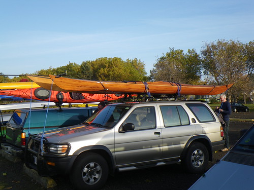
We planned for a paddle over to Chatham/Discovery Islands this morning. The tides and currents looked favourable, and even the weather looked like it would cooperate. Yes, last night's weather forecast called for clouds this morning, but it still promised to be decent paddle weather on a flat sea.
Come morning however, the clouds appeared as promised, but brought their children, their in-laws and their neighbors with them.
Foggy Pano 1

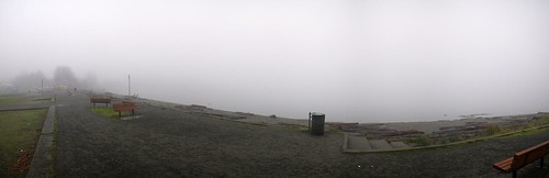
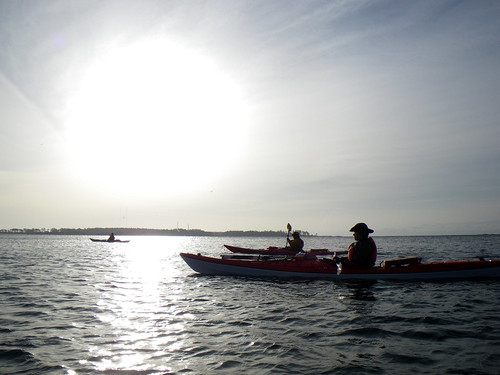
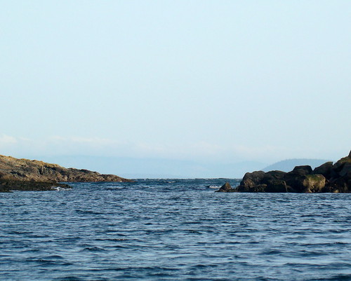
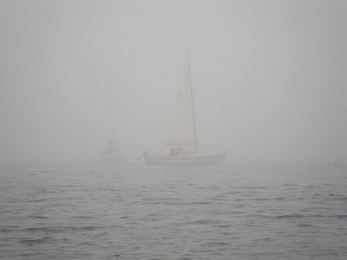
We were absolutely socked in. We've paddled in fog here before, but this was the thickest we'd seen it here on a paddle day.
2008-11-30 The Fog 026

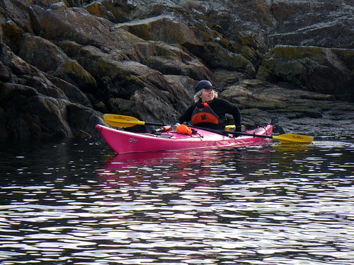
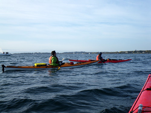
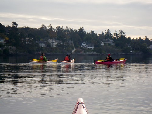
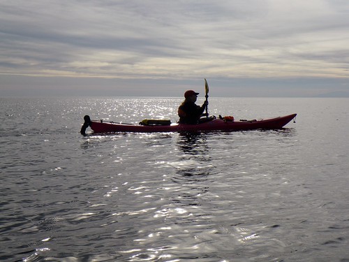
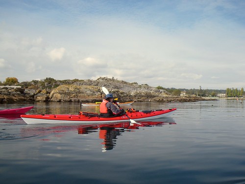
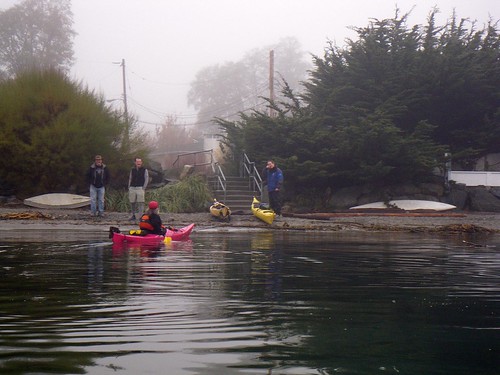
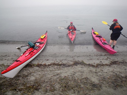
It was just Paula, Louise and myself today. We were well-equipped for the fog, each of us with a compass as well as my GPS, so a paddle out to the islands would probably have been technically feasible, but it really was thick fog and showing no sign that it was ever going to burn off anytime soon. (And it didn't burn off all day.) So we decided to stick close to shore and paddle south down to Willows Beach and explore the rock gardens along the way. No sooner had we launched than we saw Mike Jackson and some friends assessing the conditions. Paula never misses a chance to talk kayaks.
2008-11-30 The Fog 027

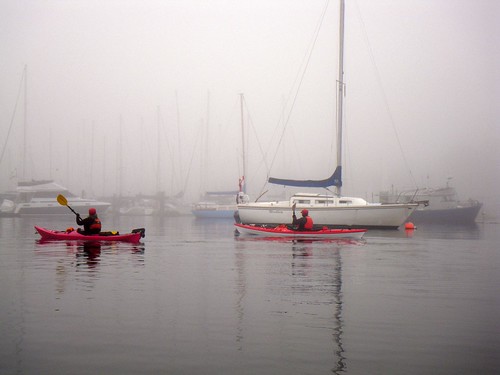
We passed by the Yacht Club...
2008-11-30 The Fog 030
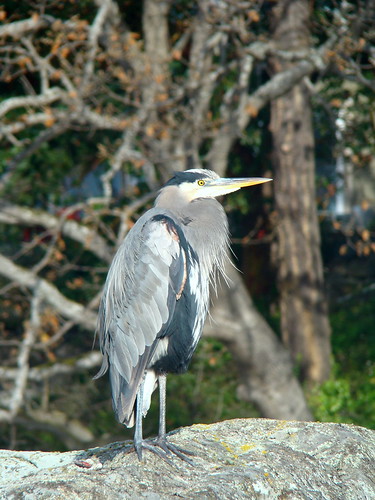
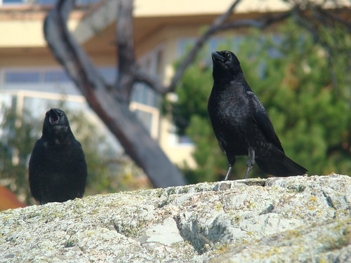
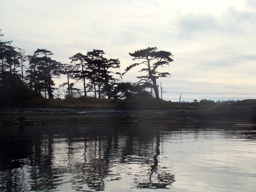
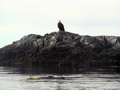
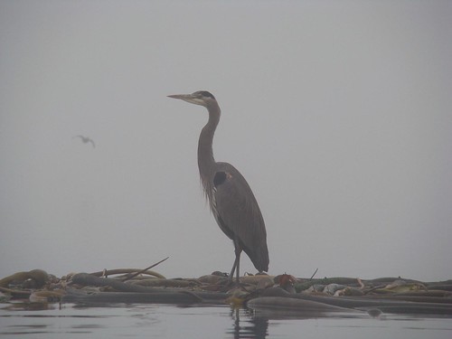
...and discovered that the fog was so thick that even the herons were grounded.
2008-11-30 The Fog 071

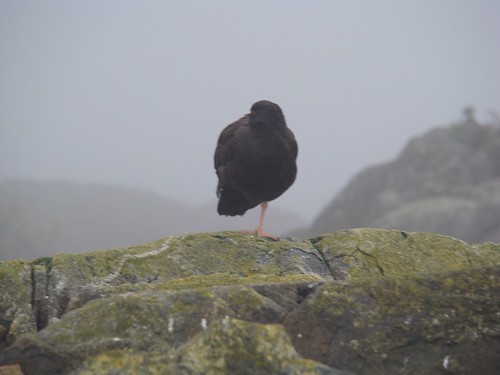
In fact, many birds weren't flying today. Many of them were asleep! We passed by a number of small islands covered with oystercatchers that were sleeping. I wonder if the thick fog was confusing them, as if they hadn't realized that the sun had come up.
2008-11-30 The Fog 042
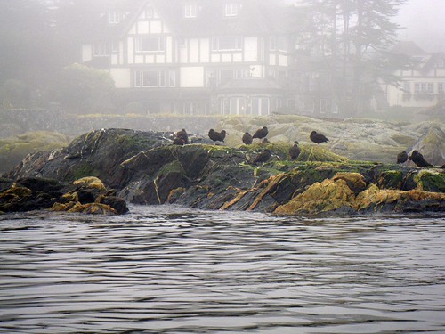
And what's with this sleeping on one foot thing? That does not look comfortable!
2008-11-30 The Fog 096

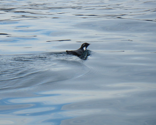
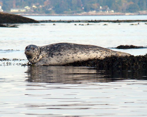
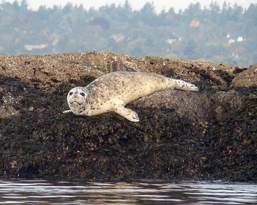
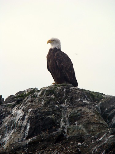
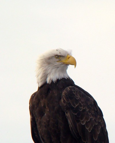
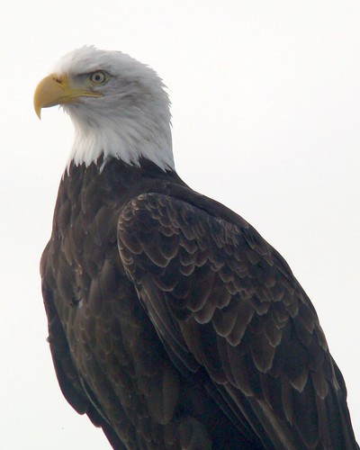
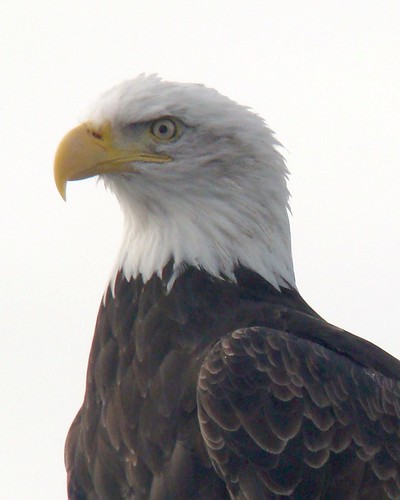
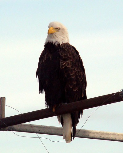
While I was checking out the oystercatchers, I saw this colourful head pop up.
2008-11-30 The Fog 089
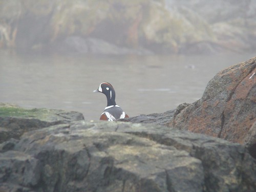
I drifted around the little island and saw him again.
2008-11-30 The Fog 098

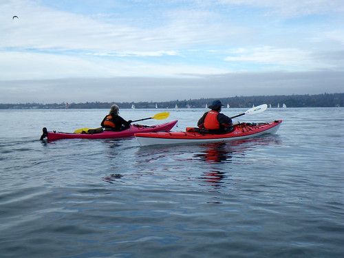
We paddled down down to Mary Tod Island, then turned around to head back. Here's Paula and Louise just off Willows Beach (trust me -- there's a beach there)...
2008-11-30 The Fog 051
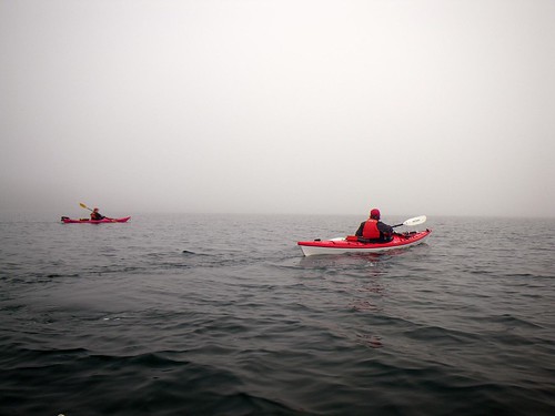
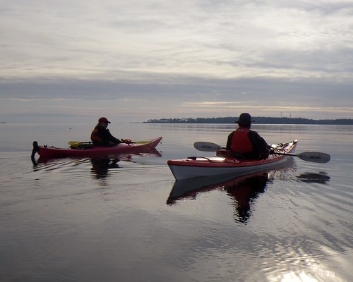
....as Mike Jackson's group came out of the fog. They were headed down to Trial Island (and you can read about their paddle here).
2008-11-30 The Fog 052

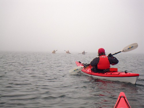
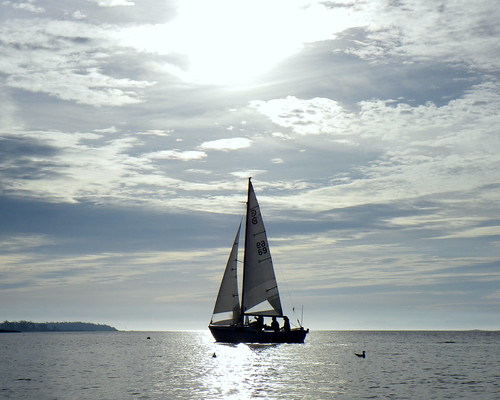
The fog was getting thicker on the return trip. We had to keep our eyes open as other boats were out playing in the mist.
2008-11-30 The Fog 059

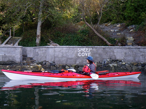
Soon, we approached our launch point on the beach at Cadboro Bay. (Once again, you'll have to trust me.)
2008-11-30 The Fog 049

A happy landing!
2008-11-30 The Fog 069

fog

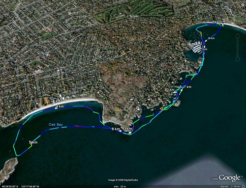
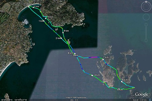
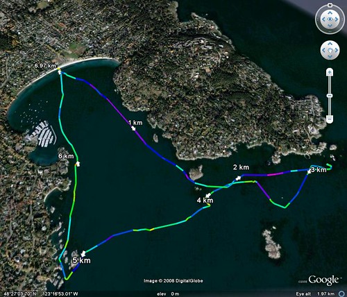
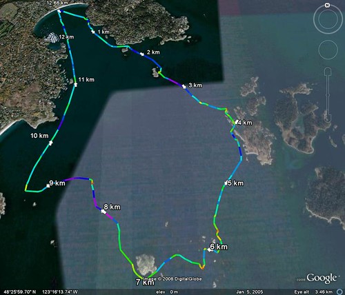
Trip Length: 8.47 km.
My photos are here.
The Google Earth kmz is here.

Saturday, November 22, 2008

2008.37.130 - Pool It!

It's dark out, it's cold, it's windy. It may even rain. A perfect time to go kayaking -- in a pool!
Richard, Louise, Paula and I spent this evening practising at Crystal Pool.

Richard was the first in the pool, and the first to go over.
2008-11-22 Pool It 001

Paula soon joined him....
2008-11-22 Pool It 004

...and so did Louise.
2008-11-22 Pool It 006

We practised our sculls, bracing, wet exits and rescues. I worked on hip flicks on the side of the pool, while Paula concentrated on doing scoop rescues. Richard worked on scrambles, while Louise practised her paddle float self-rescue.
2008-11-22 Pool It 011

And we all got too much chlorinated water up our noses! But it was a fun evening!
2008-11-22 Pool It 010

My pictures are here.

Sunday, November 16, 2008

2008.36.129 - A Quick One

We loaded up the kayaks for the drive to Cadboro Bay in early morning fog. Not pea soup-thick fog or a London fog, but thick enough to debate the merits of a crossing to Chatham Island. But as we drove to the launch point the fog thinned out to the point that it looked like it wouldn't be a problem. It was still an issue over land, but offshore the fog gave way to high clouds and the occasional bit of blue sky.

So Louise, Paula and I headed out for a crossing to Chatham Island.
2008-11-16 Chatham 010

Sailboats were out from the yacht club. There was only a slight breeze, but enough to get them going.
2008-11-16 Chatham 007

We crossed first to Jemmy Jones Island. While I tried (and failed) to get a picture of an eagle, Paula went in close to shore to examine some tidal pools, and got caught on a rock. "I just left behind a big pink smear," she said.
2008-11-16 Chatham 015

From there, we enjoyed a calm and flat crossing to Chatham. There wasn't much in the way of wildlife today. I guess all the seals and eagles took the day off. We puttered around and then turned to head back through a channel that I didn't remember having ever gone through. Then it narrowed up and the current picked up. And then I realized it was the little channel where I went over a couple of years ago. No mishaps to report today, though.
2008-11-16 Chatham 019

As we made the return crossing, we could see the fog was still hanging over the city.
2008-11-16 Chatham 030

We also saw these little birds. We couldn't remember seeing them before. They were fishing in groups and we wondered if they were migratory and just making a pit stop.
2008-11-16 Chatham 031

We made a small diversion to Sheep Cove. You can tell, because it says "Sheep Cove" on the rock wall. And, no we didn't see any sheep.
2008-11-16 Chatham 033

As we paddled through the islets near our landing spot, we saw this heron.
2008-11-16 Chatham 054

The crows demanded that I pay attention to them, too.
2008-11-16 Chatham 056

caddy2chatham

Trip length: 11.2 km
My pictures are here.
The Google Earth kmz is here.

Sunday, October 26, 2008

2008.35.128 - Windy Day on the Bay

We weren't sure if we were going to have much of a paddle today as Louise, Richard, Paula and I met at Cadboro Bay beach. Wind warnings were up, and Richard's pocket weather station was picking up gusts of 15 knots on shore. Our initial idea of going out to Chatham Island was up in the air (no pun intended), but Cadboro Bay itself was reasonably sheltered so we thought we would poke our noses out of the end of the bay and see what the channel beyond looked like.
We weren't the only people out for a paddle; Ocean River brought down a bunch of kayaks for lessons, and a couple arrived with these beautiful wooden boats on their SUV.
IMGP0708

We headed out to Flower Island, and looked out to Jemmy Jones and Chatham Islands beyond to the east. Looking north, we could also see that the "freight train" was running full bore. The flooding tide and northerly winds were kicking up a large standing wave and breakers across Baynes Channel. As the forecast was calling for the winds to increase, it was clear that we weren't going to cross today.
IMGP0721

We decided to head north along Ten Mile Point towards the lighthouse at its tip. This was one of the few times that Richard looked at us and thought we were nuts. Usually, it's the other way around. But we assured him we had no intention of going further -- that would have put us right into the "freight train," and let's face it, we're wimpy flat water paddlers at heart.
It was a tough slog at times as the winds were getting stronger just as forecast. One of us (who will remain anonymous but her initials are Louise) was heard to remark, "I [DELETED EXPLETIVE] hate [DELETED EXPLETIVE] kayaking!" as the waves bounced her boat around and she somehow ended up with spray in her ears.
This is a small channel near the lighthouse. It's usually flat calm, maybe the occasional swell, and we've rarely seen a wave on the water beyond, but today it was a little gnarlier. The wind was not kicking up really large waves where we were, but it was coming in at close to its forecast 20-25 knots and paddling was becoming more like work than fun.
DSC01662

So we turned around to head back...
IMGP0735

...and almost got run over by a flotilla of sailboats.
IMGP0728

It was good to see that someone was enjoying the windy day!
IMGP0730
IMGP0734

Cadboro Bay
Trip length: 6.97 km
My photos are here.
The Google Earth kmz is here.

Sunday, October 12, 2008

2008.34.127 - Silver and Gold

The sun glinted off the glassy flat sea in sparkles of silver and gold as Paula, Richard, Louise and I put in the water early on Sunday.
2008-10-12 Chatham to Chains 003

The water was dead flat, practically a mirror.
2008-10-12 Chatham to Chains 004

As I paused fo a moment to watch a heron, the other three had a quick discussion. Richard decided that he wanted to head south and check out Trial Island, while the rest of us would putter around and meet him out at the Chain Islands. We checked our radios to make sure they were working, and Richard headed off while the rest of us headed out toward Flower Island.
2008-10-12 Chatham to Chains 009

From there, Chatham Island beckoned. The currents were mild as we paddled across under the clouds.
2008-10-12 Chatham to Chains 012a

We saw a few seals, but they were camera shy. After skirting the south side, we turned to make for the Chain Islands.
2008-10-12 Chatham to Chains 039
2008-10-12 Chatham to Chains 023

When we got to the Chains, we saw more seals, and they were a little more willing to pose.
2008-10-12 Chatham to Chains 056
2008-10-12 Chatham to Chains 047
2008-10-12 Chatham to Chains 048a
2008-10-12 Chatham to Chains 050a

Although the water was flat, there were currents pushing through the Chains, turning us around. This can a tricky place when the currents really get going. Then I spotted an eagle on a rock.
2008-10-12 Chatham to Chains 062

I drifted in close....
2008-10-12 Chatham to Chains 071
2008-10-12 Chatham to Chains 080a
2008-10-12 Chatham to Chains 078b
2008-10-12 Chatham to Chains 088
2008-10-12 Chatham to Chains 088a
...and snapped pictures like crazy.

As we paddled around the far side of Great Chain Island (and scaring a dozen or so seals into the water as we did), we saw a speck heading our way from Trial Island. We waited for Richard, floating in the current around Great Chain. When he arrived, he said, "It was a high-pitched squeal on the Bernie-Cackle-Meter™! You guys would've killed me if I had dragged you down there! As soon as I hit the point, there was rough and confused water. The currents around Trial were crazy! I was paddling like mad and going nowhere!"
The currents where we were were not as crazy, but they were moving us quickly along. We thought for a moment that we could ride all the way back to Cadboro Bay, but we soon realized that they were taking us through Baynes Channel and out to sea. That meant that it was time to start paddling again.
2008-10-12 Chatham to Chains 031

We headed towards Mary Tod Island near the shore, but I took a detour as I had spotted something perched on the navigational light.
2008-10-12 Chatham to Chains 105
2008-10-12 Chatham to Chains 108b

We headed back into Cadboro Bay, and the water was even smoother than when we left! A great paddle!
2008-10-12 Chatham to Chains 033

Chatham2chains
Trip length: 12.66 km
My pictures are here.
The Google Earth kmz is here.